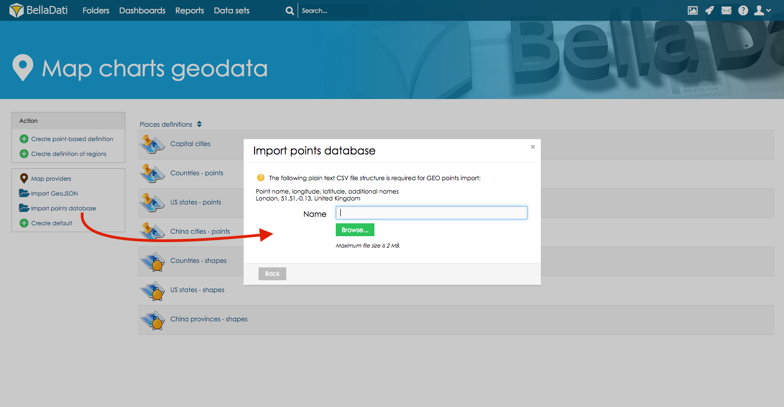
GEO Points file format
Your CSV file with GEO location points must have exact format on picture below. Please note the delimiter type and no blank spaces are accepted. Each GEO point is defined by its latitude and longitude coordinantes. You have to define associated drill-down values to match drill-down members in the report view. You can associate more drill-down values to single GEO point definition. Upper and lower case are distinguished (eg. New York, new york, NY are different values).

This picture includes GEO POINTS for streets of Chicago city as following - Street Name, longitude, latitude (longitude and latitude exactly in this order)
- In the Map charts geodata screen click on the Import points database and import CSV file in format described in the note section
- Click on the imported points data to edit data or proceed to report to create New Map
Following options are available
- Add definition entry (to add new latitude and longitude definitions into the exiting definition)
- Export option will export existing definition into the NameOfExistingDefinition.csv
- Delete definition will delete existing definition
- Back to overview will return user to overview of all available definitions
On the screen of the particular GEO points definition user can edit following parameters
- Name,
- Latitude
- Longitude
- Associated drill-down values (multiple parameters can be inserted by using , as an delimiter)
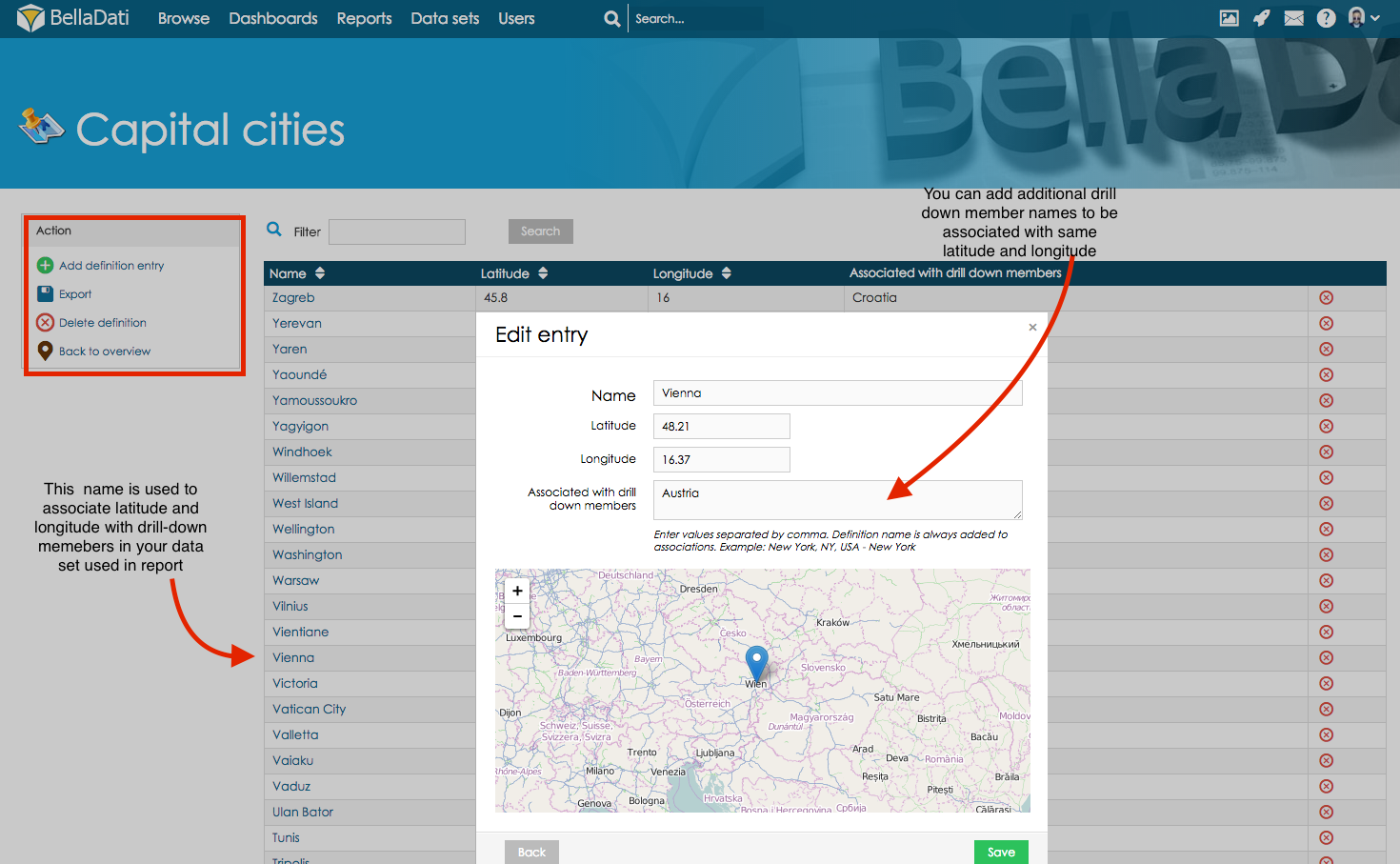
Associate with other drill-down members
Name of the GEO point will be associated with drill-down members in your data set used to create new map in report. Using Associated with drill-down members section you can associate latitude and longitude as well with other drill-down member. Example - City of Vienna has got associated latitude and longitude in Geo Points definition. If your data set includes as well state Austria. You can define it in Associated with drill-down members section and same latitude and longitude will be associated with Austria.
Tip how to upload geo data other way
Include the GEO point definition in the regular data import mapping the longitude/latitude to the GEO Point attribute type. But if you need to use Show details for option during creating new maps in report import GEO data trough Map Charts Geo Data section as described below.
Overview
Content Tools