No Translation available yet
You have Slovak selected as language but this page has not been translated yet. Translate the page or view the content in the default space language below.
Display default
- In the Map charts geodata screen click on the Import points database and import CSV file in format described in the note section
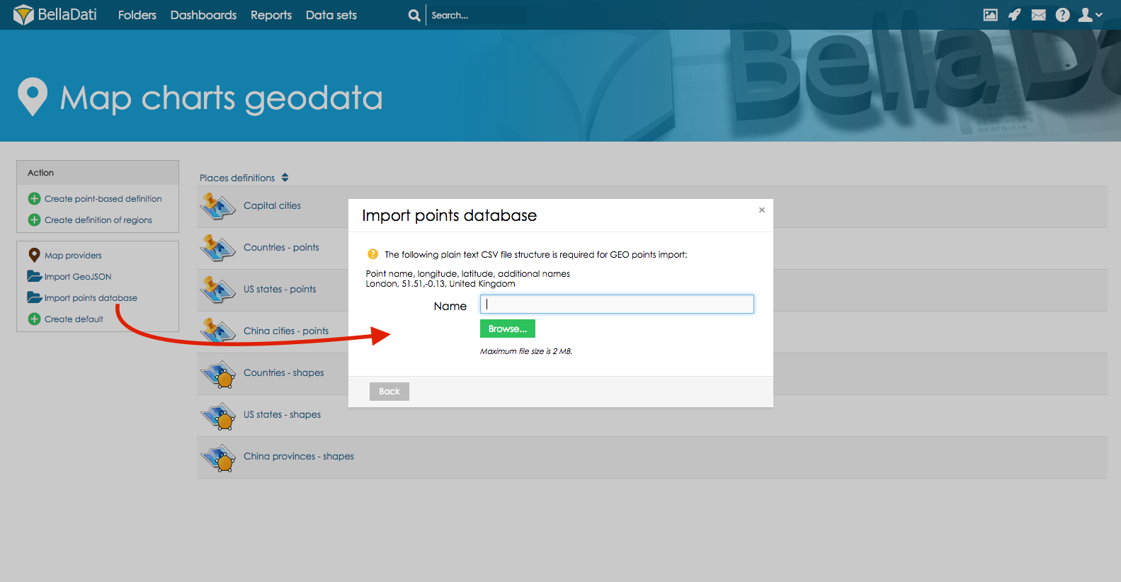
- Click on the imported points data to edit data or proceed to report to create New Map
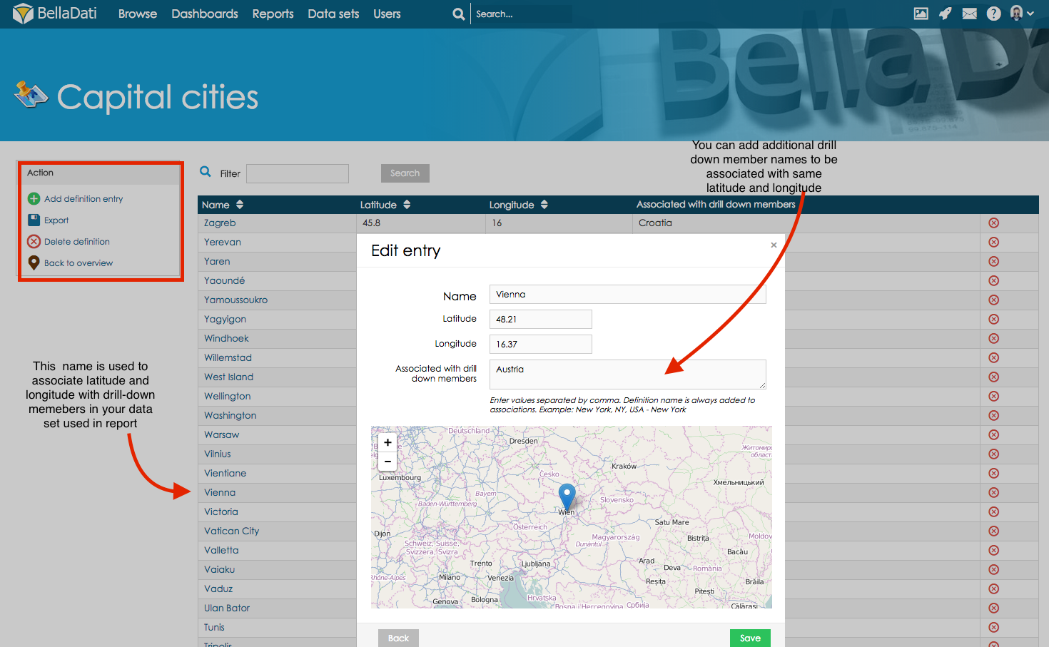
Following options are available
- Add definition entry (to add new latitude and longitude definitions into the exiting definition)
- Export option will export existing definition into the NameOfExistingDefinition.csv
- Delete definition will delete existing definition
- Back to overview will return user to overview of all available definitions
On the screen of the particular GEO points definition user can edit following parameters
- Name,
- Latitude
- Longitude
- Associated drill-down values (multiple parameters can be inserted by using , as an delimiter)