Page History
| Sv translation | ||||
|---|---|---|---|---|
| ||||
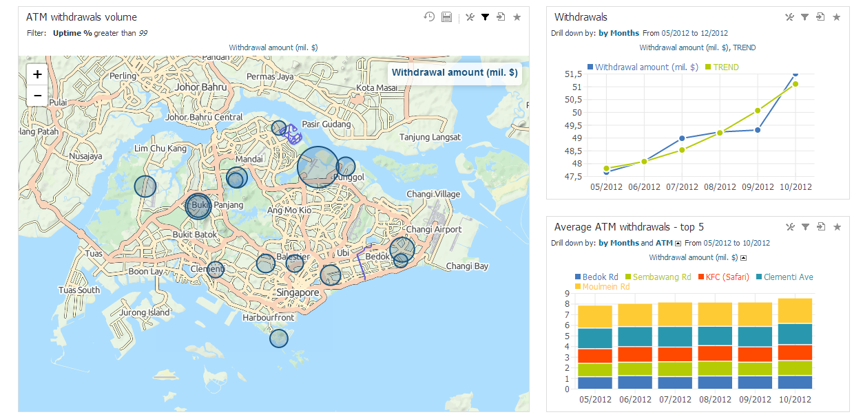
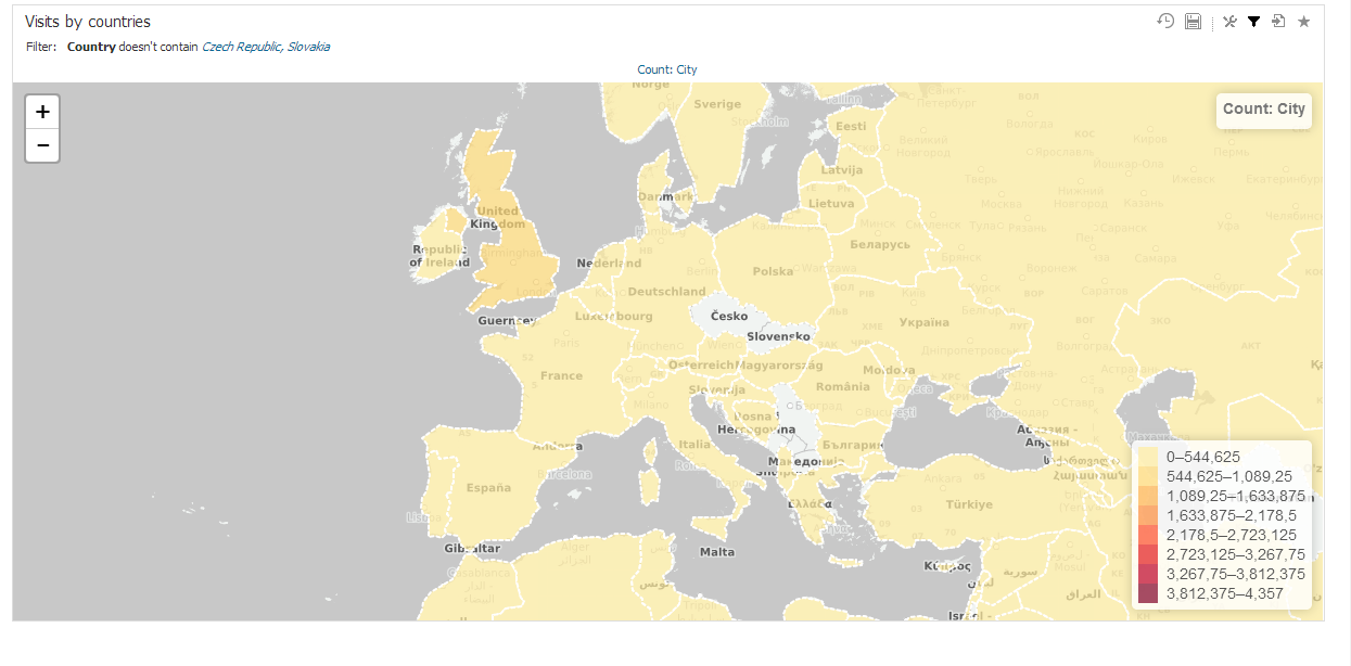
BellaDati supports visualizing data in geo maps using two options:
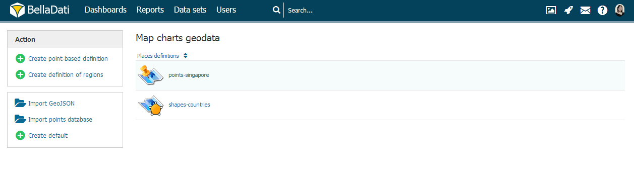
Click "Map charts geodata" in Data set menu to manage GEO points and regions.
Available actions:
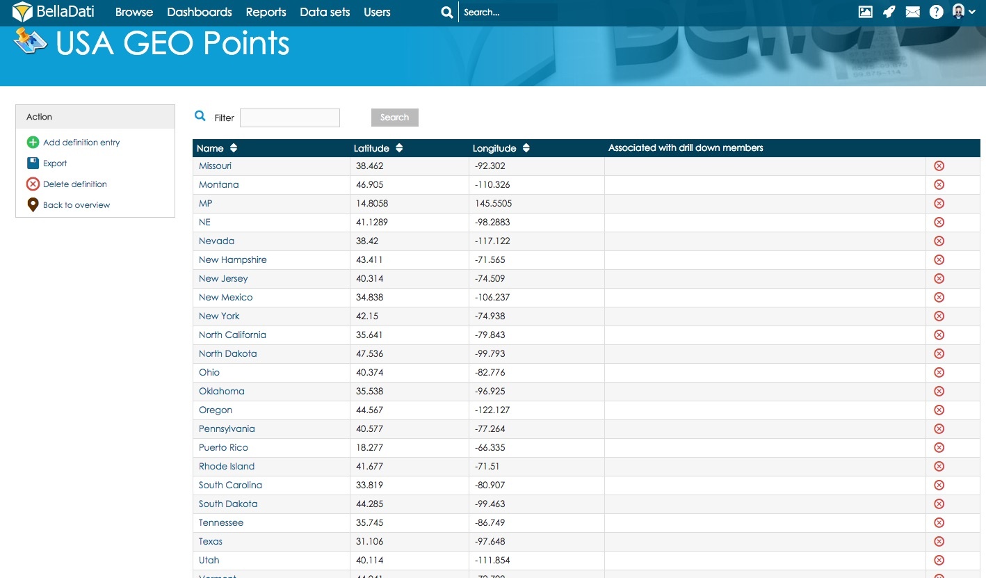
GEO Points
Your CSV file with GEO location points must have exact format on picture below. Please note the delimiter type and no blank spaces are accepted. Each GEO point is defined by its latitude and longitude coordinantes. You have to define associated drill-down values to match drill-down members in the report view. You can associate more drill-down values to single GEO point definition. Upper and lower case are distinguished (eg. New York, new york, NY are different values).
This picture includes GEO POINTS for streets of Chicago city as following - Street Name, latitude, longitude
Following parameters are manageable for GEO points:
GEO RegionsEach GEO region is defined by three or usually more points specified by latitude and longitude coordinantes. Standardized GeoJSON format is supported to simplify importing these definitions. You have to define associated drill-down values to match drill-down members in the report view. You can associate more drill-down values to single GEO region definition. Upper and lower case are distinguished (eg. Canada, canada, CAN are different values). Following parameters are manageable for GEO regions:
Next Steps |


| Sv translation | ||||
|---|---|---|---|---|
| ||||
BellaDati podporuje zobrazovanie dát v mapách dvomi možnosťami:
Pre spravovanie bodov a tvarov kliknite na "Geodata pre mapy" v ľavom menu na stránke zoznamu skupín dát.
Dostupné operácie
GEO body
Každý GEO bod je definovaný jeho zemskou šírkou a dĺžkou. Aby sa GEO body naviazali na jednotlivé hodnoty atribútov musíte im tieto hodnoty priradiť v nastaveniach bodu. S jedným GEO bodom môžete asociovať viacero hodnôt atribútov. Pri zadávaní sa rozlišujú veľké a malé písmená (napr. New York, new york, NY sa chápu ako rozdielne hodnoty). Pre GEO body sú nastaviteľné nasledujúce parametre:
GEO regiónyKaždý GEO región je definovaný tromi alebo viacerými bodmi určenými podľa zemskej šírky a výšky. Štandardizovaný GeoJSON formát je podporovaný pre zjednodušenie importu týchto definícií. Pre zobrazenie regiónu v reporte musíte v jeho nastaveniach nastaviť združeného hodnoty atribútu. Podobne ako GEO point môže mať región pridelených viacero hodnôt atribútu. Pri zadávaní sa rozlišujú veľké a malé písmená (napr. Canada, canada, CAN sú chápané ako rozdielne hodnoty). Nasledujúce parametre sú nastaviteľné pre GEO regióny:
Kam ďalej |
Overview
Content Tools